Back to RTG Spectrum

Geospatial RF Analytics

Position-aware RF sensing, coverage mapping, and emitter estimation.

RTG Spectrum connects RF, wireless, cellular, GPS, and mission events into geospatial workflows that help teams map coverage, establish baselines, estimate likely source areas, detect change, and decide where to collect next.

Public-safe capability

From observations on a route to location-aware engineering evidence.

A single RF observation is useful, but route-tagged observations are much more powerful. Cellular signal measurements, WiFi and BLE detections, RF Sentinel entities, AirScope survey records, SDR-Shark spectrum context, and PASSIVE-SHIELD prototype cues can all carry time, signal, source, and location context where available.

RTG Spectrum uses that context to support coverage maps, likely-source estimation, uncertainty review, Pattern-of-Life analytics, and follow-on collection planning. The public examples are sanitized and representative; they do not expose private routes, hardware identifiers, deployment details, or live operational data.
What this enables

  • GPS-tagged RF, WiFi, BLE, cellular, and mission event review
  • Coverage-map and drive-test style visualization
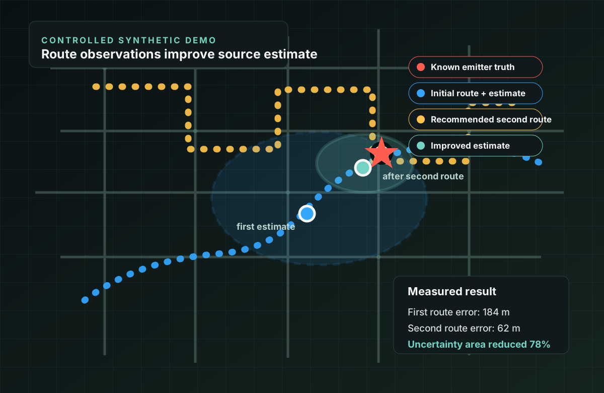
  • Likely emitter or tower-area estimation from repeated observations
  • Uncertainty-aware evidence instead of overconfident point claims
  • Next-best-measurement planning for follow-on surveys

Route-based survey

Cellular Survey provides the clearest public geospatial artifact.

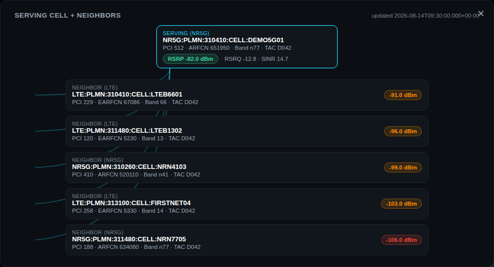
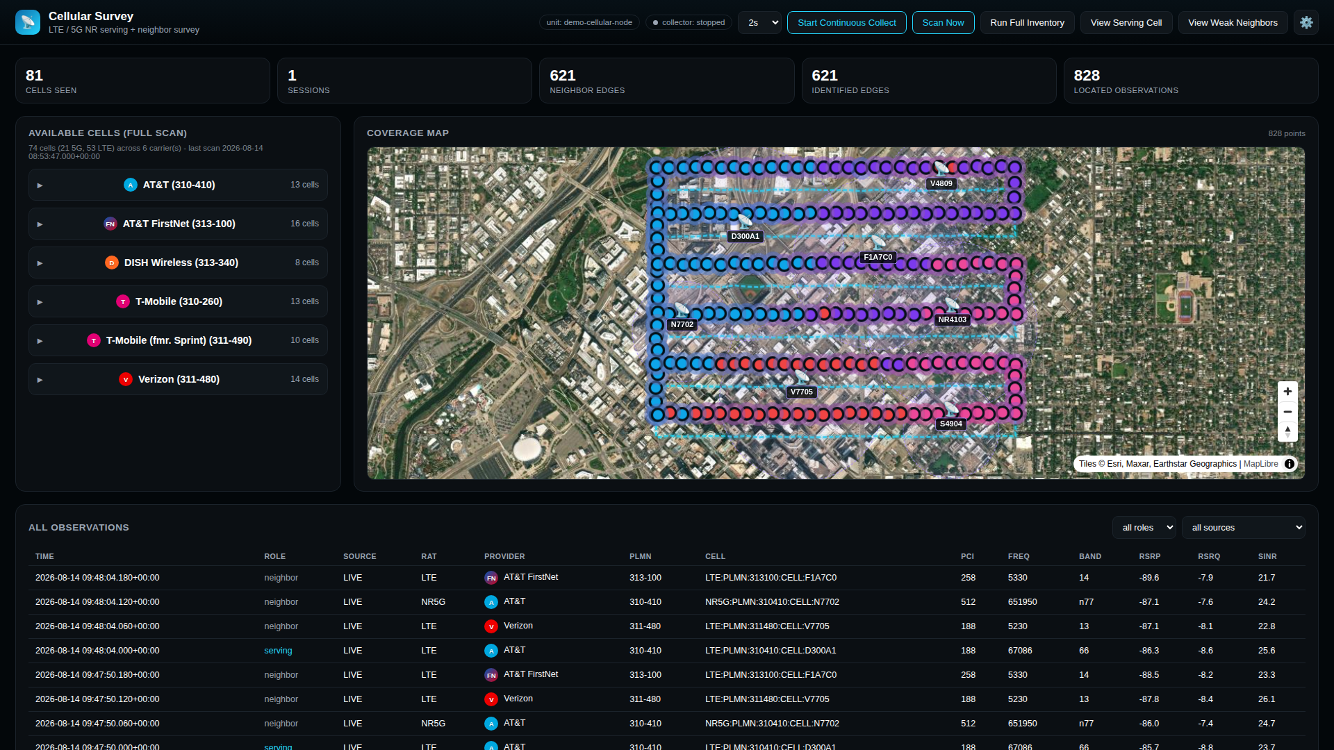
Cellular Survey shows LTE and 5G NR inventory, serving and neighbor context, high-rate signal measurements, optional PCAP recordings for offline engineering review, and coverage-map observations. In public-safe demo views, synthetic observations follow a street-grid drive-test pattern so reviewers can see how signal measurements become map evidence.

Cellular Survey public-safe street-grid drive-test map with LTE and 5G observations

Shared geospatial pattern

The same positioning concept appears across multiple modules.

Cellular Survey

Route-tagged cellular measurements support coverage review, serving/neighbor context, tower-area estimation, and future location-aware analytics.

RF Sentinel

Repeated observations of decoded entities can support likely-source estimation for WiFi, BLE, and other protocol-visible emitters when location context is available.

AirScope

Wireless surveys add AP/station topology, channel behavior, recurrence, GPS-aware coverage context, and reportable baseline evidence.

PASSIVE-SHIELD

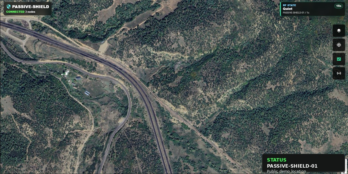
Defense prototype cues can be represented as source-aware events with station context, track identity, and bounded multi-station planning analysis.

Trace Analyzer

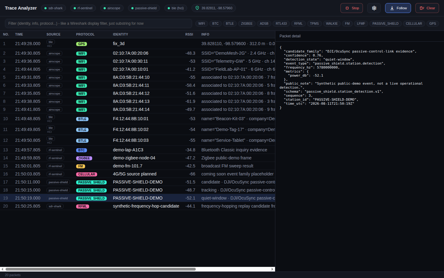
Source-aware timelines let operators compare RF, WiFi, BLE, cellular, GPS, spectrum, and mission events without losing where each observation came from.

Planning Tools

Simulation and replay tools help test station geometry, route coverage, measurement averaging, and expected uncertainty before field work.

Claim boundaries

Useful geospatial RF analytics require honest uncertainty.

The public claim is not precision geolocation for every signal. RTG Spectrum treats position estimates as engineering evidence with uncertainty, data-quality limits, and source-specific caveats. Fixed-station layouts, route geometry, measurement density, signal calibration, terrain, and protocol visibility all affect what can be claimed.

That boundary is a strength: the platform is built to show what was observed, how often, from which source, where context was available, and what the operator can reasonably infer.

Not claimed here

  • Universal emitter attribution or precision location
  • Subscriber tracking, interception, or carrier-network access
  • Production cellular geolocation
  • Fielded operational C-UAS defeat capability
  • Location claims without sufficient observation geometry

Demo video

A short geospatial RF demo video can be linked here next.

The next public artifact should show a scenario: baseline route, new RF or cellular observations, estimated source area or coverage change, Trace Analyzer context, and recommended follow-on collection. Once the YouTube video is uploaded, this section can link directly to it.