Back to Case Studies

Case Study

Controlled geospatial RF location estimation demo.

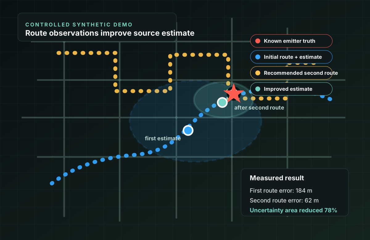
A public-safe synthetic scenario showing known emitter truth, route-based observations, an estimated source area, uncertainty, a recommended second route, and a quantified improvement after collecting better geometry.

Problem

Likely-source estimation needs geometry, uncertainty, and a measurable truth reference.

RF maps can look persuasive even when the underlying collection geometry is weak. This demo uses a controlled synthetic emitter with known truth so the platform can measure error directly, show uncertainty honestly, and recommend a second route that should improve the estimate.

Scenario Inputs

  • One known synthetic emitter truth point
  • Initial drive route with partial bearing diversity
  • Signal-strength observations with repeatable noise
  • Estimated source area and uncertainty ellipse
  • Second route selected to improve observation geometry
Result

Demonstrated location estimation with quantified error under controlled conditions.

First route

60 observations along a partial route produced a likely source area with 184 m error from known truth and a broad uncertainty ellipse.

Recommended route

The platform selected a second route that crossed the weak side of the estimate instead of repeating the same collection geometry.

Improved estimate

After 60 additional observations, error dropped to 62 m and the uncertainty area decreased by 78% in the controlled synthetic scenario.

Technical approach

Route-tagged observations become an uncertainty-aware source estimate.

The demo treats each observation as a source-aware record with timestamp, route position, signal metric, and identity context. The estimator compares signal strength across observation points, produces an estimated source area, and reports uncertainty based on observation spread and geometry. The second route is chosen to add new bearing diversity rather than simply collecting more of the same data.

What this proves

  • Known truth can be used to measure geolocation error directly
  • Route geometry materially affects location-estimation quality
  • Uncertainty should shrink only when collection geometry improves
  • Follow-on collection can be planned from the first-pass estimate

What is intentionally not claimed

  • Not a live operational geolocation claim
  • Not precision location for every RF signal
  • Not subscriber tracking, interception, or carrier-network access
  • Not a replacement for calibrated field validation
  • Not a claim that all emitters are protocol-visible or locatable

Why it matters

  • Turns geospatial RF from a feature claim into a measured workflow
  • Shows how Cellular Survey, RF Sentinel, AirScope, and Trace Analyzer fit a common location-aware pattern
  • Gives buyers a clear prototype path: measure, estimate, quantify, improve
  • Creates a strong foundation for a short YouTube demo once the video is ready